Singapore completes first below-sea-level land reclamation using Dutch empoldering method
Singapore has completed its first below-sea-level land reclamation project, creating an 800-hectare polder at the north-western tip of Pulau Tekong. The milestone project, based on Dutch empoldering methods, enhances land-use efficiency and climate resilience while conserving sand resources.
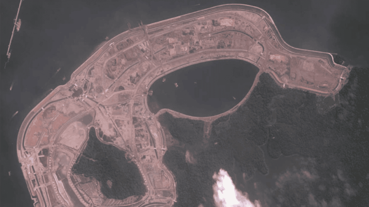
- Singapore built its first below-sea-level reclaimed land at Pulau Tekong using Dutch-style empoldering.
- The 800ha polder saves about 50% of sand compared with traditional reclamation methods.
- The project strengthens climate resilience and will be used for military training, freeing land for housing.
SINGAPORE — Singapore has completed its first below-sea-level land reclamation project through empoldering, a Dutch-inspired method that creates dry land by enclosing and draining low-lying areas. The 800-hectare polder, located at the north-western tip of Pulau Tekong, marks a major milestone in Singapore’s efforts to balance land demand with climate adaptation.
Announced jointly by the Housing & Development Board (HDB) and national water agency PUB on 8 September 2025, the newly reclaimed area will be designated for military training. This move will help free up mainland space for housing, infrastructure, and other development needs.
The site spans an area equivalent to two Toa Payoh towns, reflecting the scale of Singapore’s ongoing push to expand its land sustainably.
Prime Minister Lawrence Wong visited the project site on 8 September, returning to a project he first introduced in 2016 during his tenure as Minister for National Development.
The completion of the Tekong polder underscores Singapore’s long-term commitment to developing innovative land reclamation techniques in response to both urban pressures and rising sea levels.
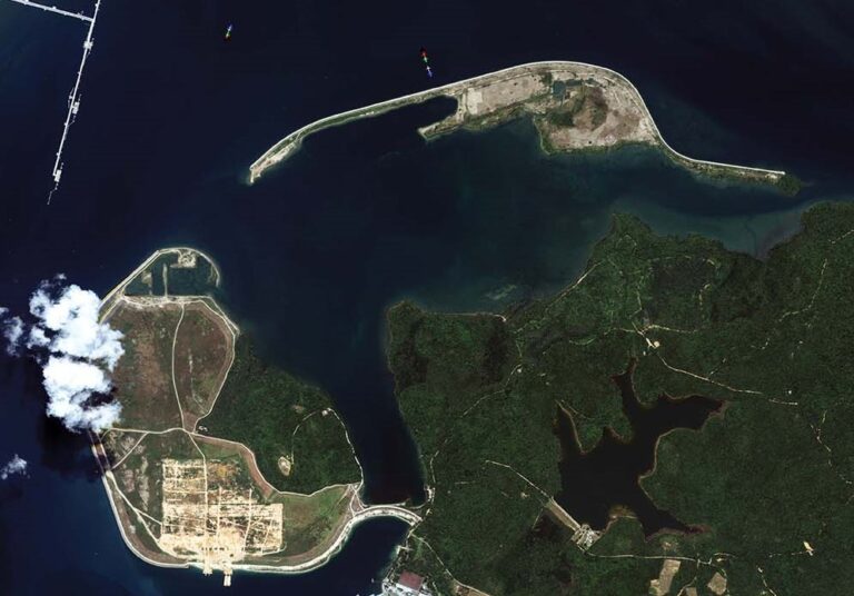
First below-sea-level reclamation in Singapore
This is the first time Singapore has reclaimed land below mean sea level. At its deepest point, the Tekong polder lies approximately 1.2 metres below average sea level. Unlike traditional reclamation methods, which require raising land above sea level using vast quantities of sand, empoldering encloses a low-lying area with dikes and uses pumps to manage internal water levels.
According to PUB and HDB, the Tekong project achieved close to 50 percent savings in sand use compared with conventional methods. The project also reused more than 10 million cubic metres of clayey soil excavated during the construction of a stormwater pond, reducing the need for imported materials and minimising waste.
Coastal protection through engineered design
The polder is protected by a 10km-long coastal dike standing up to 6 metres above mean sea level. The dike encloses the reclaimed land and safeguards it against tides and storm surges. A maintenance road runs along its crest, providing 24-hour access, while 21km of internal roads enable movement within the reclaimed area.
Authorities noted that the dike’s height can be increased in future to account for sea-level rises of up to 5 metres by the end of the century. This design flexibility forms part of Singapore’s long-term coastal protection strategy.
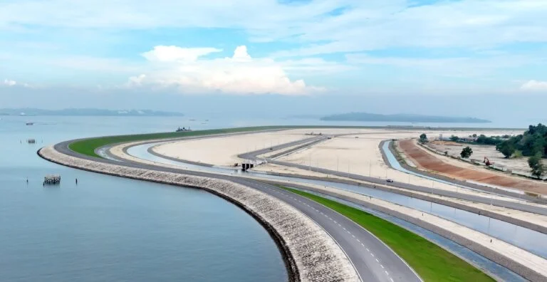
Integrated drainage and stormwater management
Given Singapore’s high rainfall and the polder’s low elevation, extensive drainage infrastructure has been installed. The system includes a 45km-long network of channels and pipes, over 30 water control structures, and a 116-hectare stormwater collection pond capable of holding up to 5 million cubic metres of water — equivalent to 2,000 Olympic-size swimming pools.
During dry weather, the system recirculates water to prevent stagnation. In heavy rain, excess water is diverted into the stormwater pond and discharged to the sea via pumping stations.
Two key pumping stations form the backbone of this system: the Central Pumping Station, which maintains water circulation within the polder, and the Drainage Pumping Station, which expels excess stormwater when levels reach critical thresholds.
PUB’s senior principal engineer Thomas Pang explained that the drainage network is monitored in real time using more than 170 CCTV cameras and 260 sensors. Data from these devices feed into the Tekong control centre and PUB’s main operations hub on the mainland, allowing for rapid response during weather events.
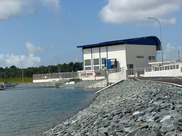
Adaptation of Dutch expertise for tropical conditions
To develop the Tekong polder, HDB and PUB collaborated closely with Dutch experts, adapting established empoldering and dike safety standards from the Netherlands to Singapore’s tropical climate. While wave action is milder in Singapore, higher rainfall intensity demanded re-engineered drainage and pumping systems to maintain internal water balance.
Officials said the project’s operational phase will serve as a reference for future reclamation projects, helping authorities assess long-term maintenance costs and technical viability.
Environmental and resource considerations
Empoldering’s reduced reliance on sand offers a key environmental advantage. Global demand for sand, estimated at around 50 billion tonnes annually, has led to widespread export restrictions in the region. Countries such as Malaysia, Indonesia, Vietnam, and Cambodia have imposed bans or curbs on sand exports due to environmental concerns, including shoreline erosion and marine habitat damage.
Indonesia’s brief lifting of its 20-year sand export ban in 2023 sparked legal challenges and public opposition. The country’s Supreme Court later annulled parts of the regulation, citing conflicts with maritime law and risks to coastal ecosystems. Against this backdrop, Singapore’s move toward sand-efficient reclamation methods aligns with regional sustainability goals and enhances resource resilience.
Future outlook and national importance
Once the final commissioning of infrastructure components is complete later in 2025, the site will be handed over to PUB and the Ministry of Defence. Beyond its immediate use for military training, the Tekong polder will serve as a testbed for future land reclamation and coastal adaptation projects.
Authorities view empoldering as a potentially scalable model for Singapore’s long-term development, combining climate resilience with land efficiency. As sea levels rise and resource constraints intensify, the lessons learned from the Tekong polder could guide the next phase of Singapore’s coastal planning and environmental management.





0 Comments