Indonesia unveils 2025 NKRI map with updated borders, new IKN designation, and expanded geospatial data
Indonesia has launched the 2025 edition of its NKRI map, adding IKN Nusantara as the future capital, revising land borders, updating provincial boundaries in Papua, and incorporating new geographical and infrastructure data.
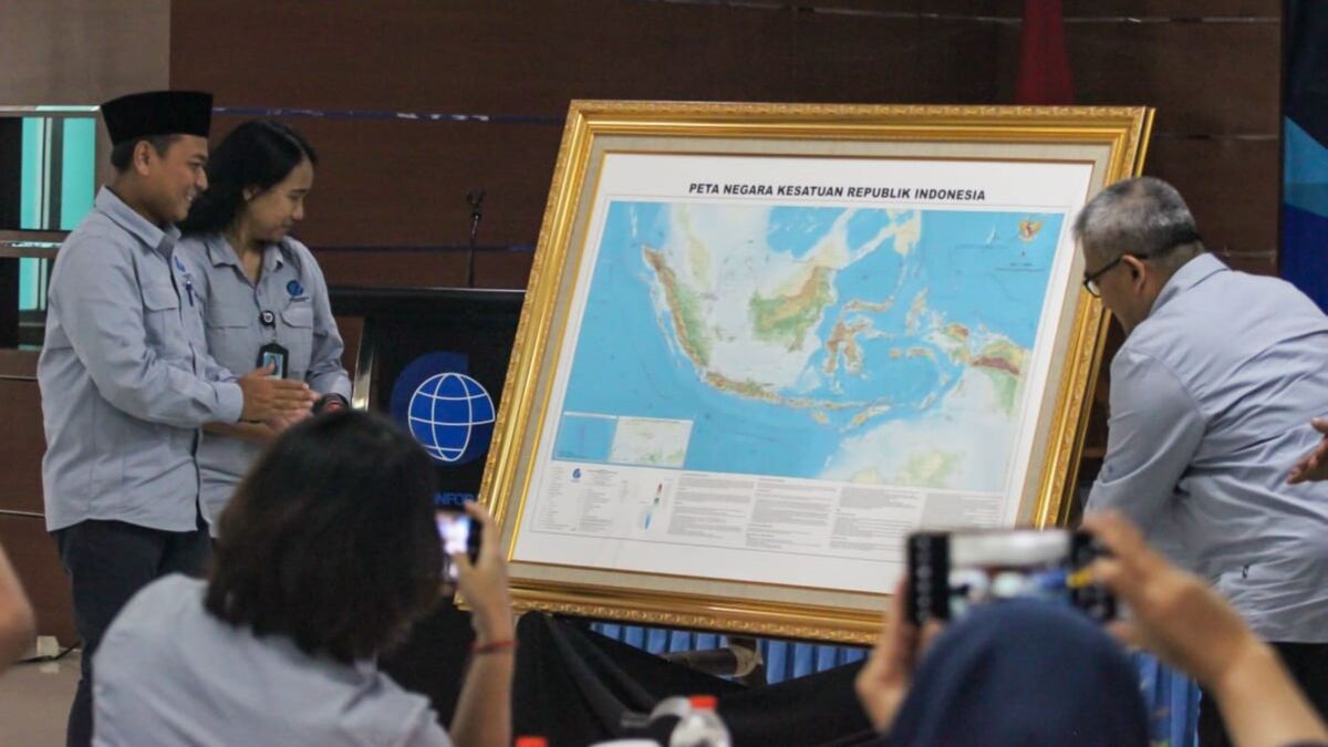
- BIG released the 2025 NKRI map with major updates, including IKN Nusantara’s formal inclusion and new provincial boundaries in Papua.
- Revised borders with Malaysia and Papua New Guinea, expanded toll-road and airport data, and ten newly charted underwater mountains feature in the update.
- Officials highlight the map’s role in defence, sovereignty protection, and advancing geospatial literacy.
INDONESIA — Geospatial Information Agency (BIG) has launched the 2025 edition of the Map of the Unitary State of the Republic of Indonesia.
According to the agency’s release, the update marks a key step in maintaining accurate territorial information for an archipelagic nation comprising 17,380 islands.
Head of the agency, Muh Aris Marfai, said the map reinforces Indonesia’s identity as a maritime nation. He recalled the significance of the 13 December 1957 Deklarasi Djuanda as the foundation for asserting Indonesia’s maritime sovereignty.
The Djuanda Declaration of 13 December 1957 marked a pivotal moment in affirming Indonesia’s sovereignty as an archipelagic state, asserting that all waters surrounding, between, and connecting its islands form a single unified territory—overturning the 1939 Dutch ordinance that treated islands as separate entities with only three-mile territorial seas.
While Mochtar Kusumaatmadja’s vision, later enshrined in the 1982 United Nations Convention on the Law of the Sea (UNCLOS), framed Indonesia’s archipelagic character as the legal and diplomatic foundation for protecting national resources, strengthening maritime sovereignty, and ensuring that the sea serves as a unifying element rather than a divider of the Indonesian archipelago.
Aris stated that more than half a century after the declaration, the new map renews its spirit. He said the 2025 edition reflects ongoing efforts to keep national territorial information consistent with current realities.
The 2025 map includes a range of updates. These encompass the addition of Ibu Kota Nusantara as the prospective capital and revisions to borders with Malaysia and Papua New Guinea.
Updates to the Indonesia–Malaysia land boundary are based on several Memoranda of Understanding from 2019 to 2025. These include changes in Area II and Area III, as well as the west coast of Sebatik Island.
Revisions to the Indonesia–Papua New Guinea border rely on a joint declaration confirming the measurement of 52 meridian monuments using the World Geodetic System 1984.
According to Tribun, this measurement was completed in 2019.
The map also updates administrative boundaries across the Papua region. Six provinces—Papua, West Papua, Southwest Papua, Central Papua, Mountainous Papua, and Papua—now reflect new boundaries and revised capital locations.
This brings the total number of provinces to 38. BIG confirms that the new edition integrates these changes to provide an accurate national administrative layout.
Infrastructure updates form another significant component. The map includes revised toll-road segments across Aceh, North Sumatra, Riau, Lampung, West Java, Central Java, East Kalimantan, South Sulawesi, North Sulawesi, and Bali.
Changes to airport status have been incorporated. These follow ministerial decrees regarding international airport designations and airports permitted to host direct international flights.
Geographical features have also been expanded. The 2025 map adds ten underwater mountains located in the Indian Ocean, Sulawesi Sea, Flores Sea, and the South Pacific Ocean.
Aris said the release is part of a continuing update cycle rather than a final product. He stressed that national geospatial information must evolve in line with developments in governance, defence, and spatial planning.
During the launch, Universitas Pertahanan academic Asep Adang Supriyadi highlighted the defence implications.
He said geospatial information supported by modern geographic information systems is critical for Geospatial Intelligence.
Adang explained that accurate geospatial data underpins analysis of vulnerabilities and defence spatial planning. He noted its heightened importance in the context of the new capital Nusantara and the surrounding security needs.
Aris encouraged all stakeholders to contribute to safeguarding Indonesia’s territorial integrity. He invited cooperation in maintaining borders and preserving the country as a shared national home.